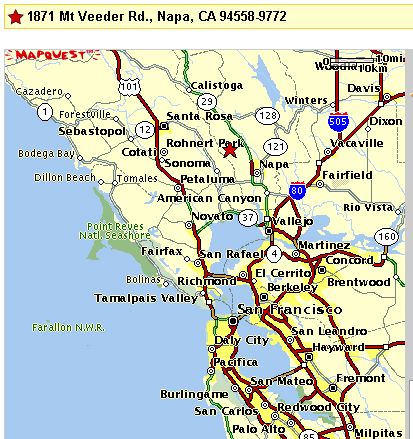
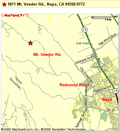
We're located at the red star on these two maps.
The preferred route from Palo Alto is across the Dumbarton Bridge, North on 880 to 80 East. You go about 25-30 miles East on 80 to 37 west and after about 2 miles then exit onto 29 North to Napa. Once on 29 North you continue to the North side of the City of Napa and take the Redwood Road exit off of 29 heading west.
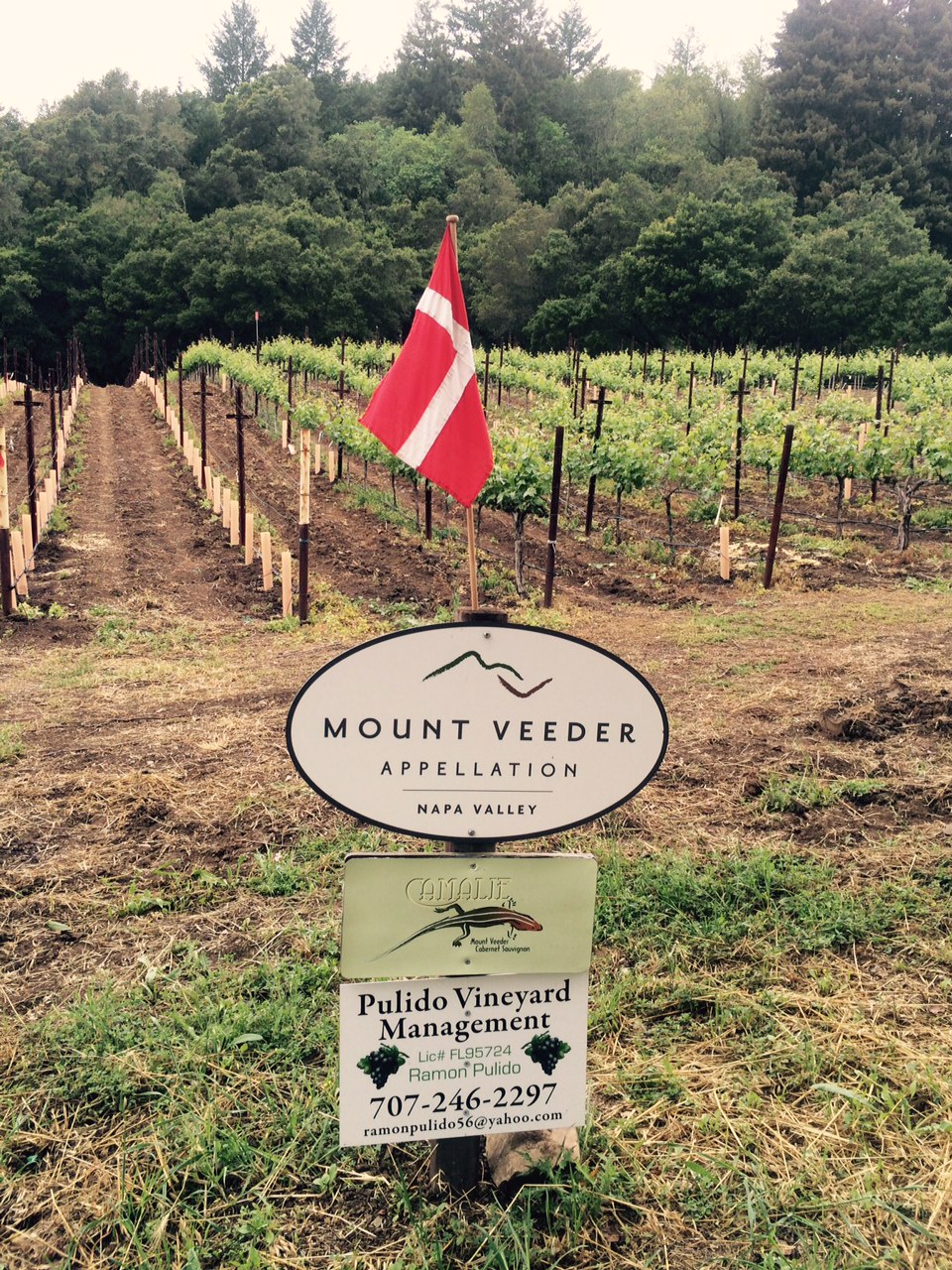
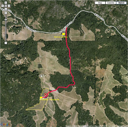
Go about 4 miles on Redwood Rd. at which point Redwood Rd. turns off to the left and the road going straight becomes Mt Veeder Rd. This junction is well marked. You want to go straight on Mt Veeder Rd for another 2 miles. You will see a big 1800 in the middle of your lane which is an address marker. Just a little past this you will see a white house and big white barn on your left. Turn left onto the gravel road just before this house. Go 0.6 miles up the hill. As you reach the crest of the hill you will come into a agricultural yard with a couple sheds and some tractors. Straight ahead about 150 yards you will see the roof of our house beyond some birch trees. Go straight across the agricultural yard and down a road under some big oak trees. You should see a Mt. Veeder Appellation sign with a Camalie Vineyards sign under it straight ahead as you traverse this road.
The road curves to the left at the sign. Go another 100 yards and you will see our garage on the right with the 1871 address numbers on it. Turn right before the garage go between some pear trees and you'll see the house straight ahead beyond the 3 birch trees and pool house. This is the part of the trip that GPS and a Google Map won't help you with.
Distance from Palo Alto is 86 miles which takes 1hr. and 45 minutes best case, 2 hours on average. From San Francisco it is only about 1hr. and 15 minutes. Rush hour traffic can add significant time to the travel.
Last Updated 5/17/16 M.H.