Vineyard Maps
Here are detailed GIS maps for the vineyard served up by a Manifold Web server.
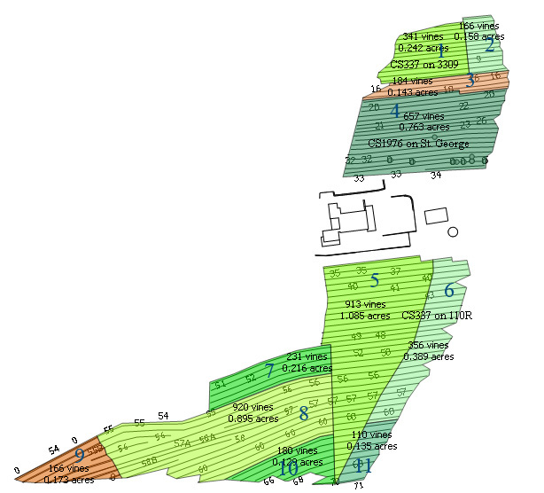
Interactive Cultivar Block Map What's planted in the vineyard
Aerial Photography - Vine vigor and Infrared
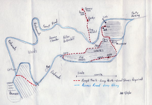
Topgraphic Map with plan for a cave.
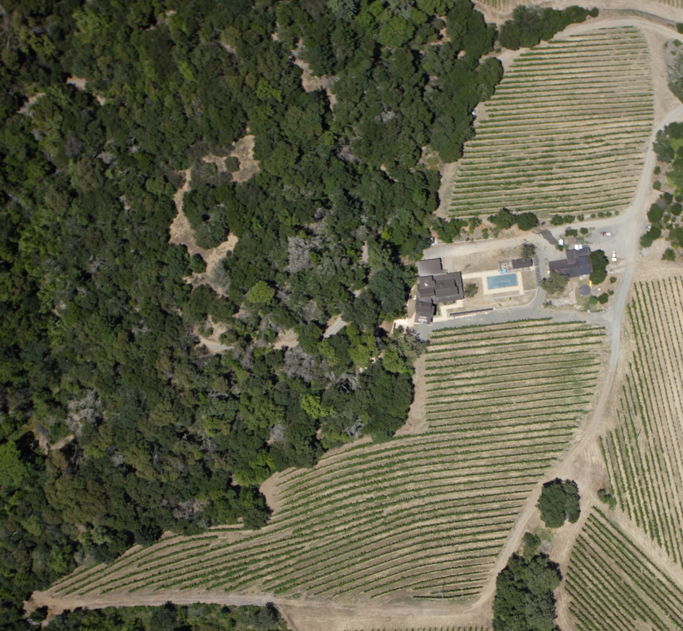
Large High resolution vineyard image by SkyHawk ~ 6/17/10 Shows relative vine vigor early in the season.
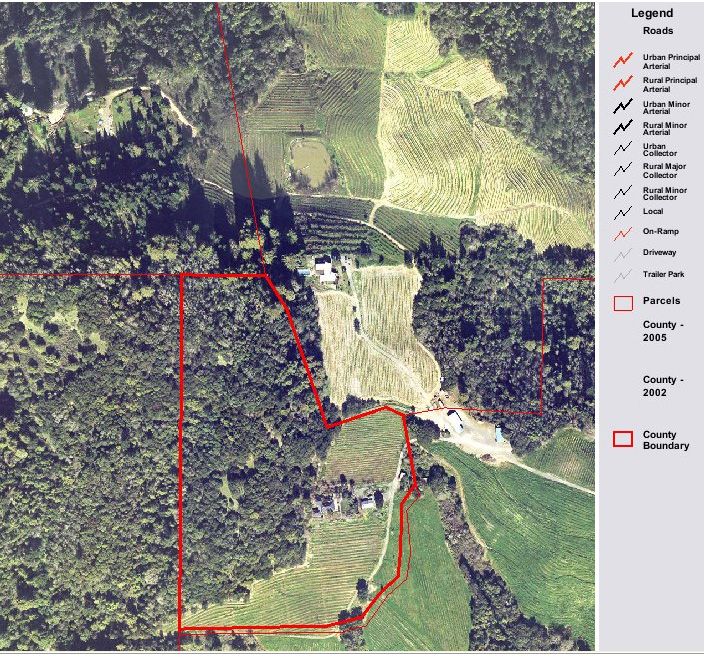
Below is a Satellite view with parcel boundaries shown from the Napa County GIS site I copied this image from http://gis.napa.ca.gov/Prcl_Smry/prcl_info.asp?parcel=034110047000&profile=CITIZEN
Super High Resolution Version of image above 2MB.
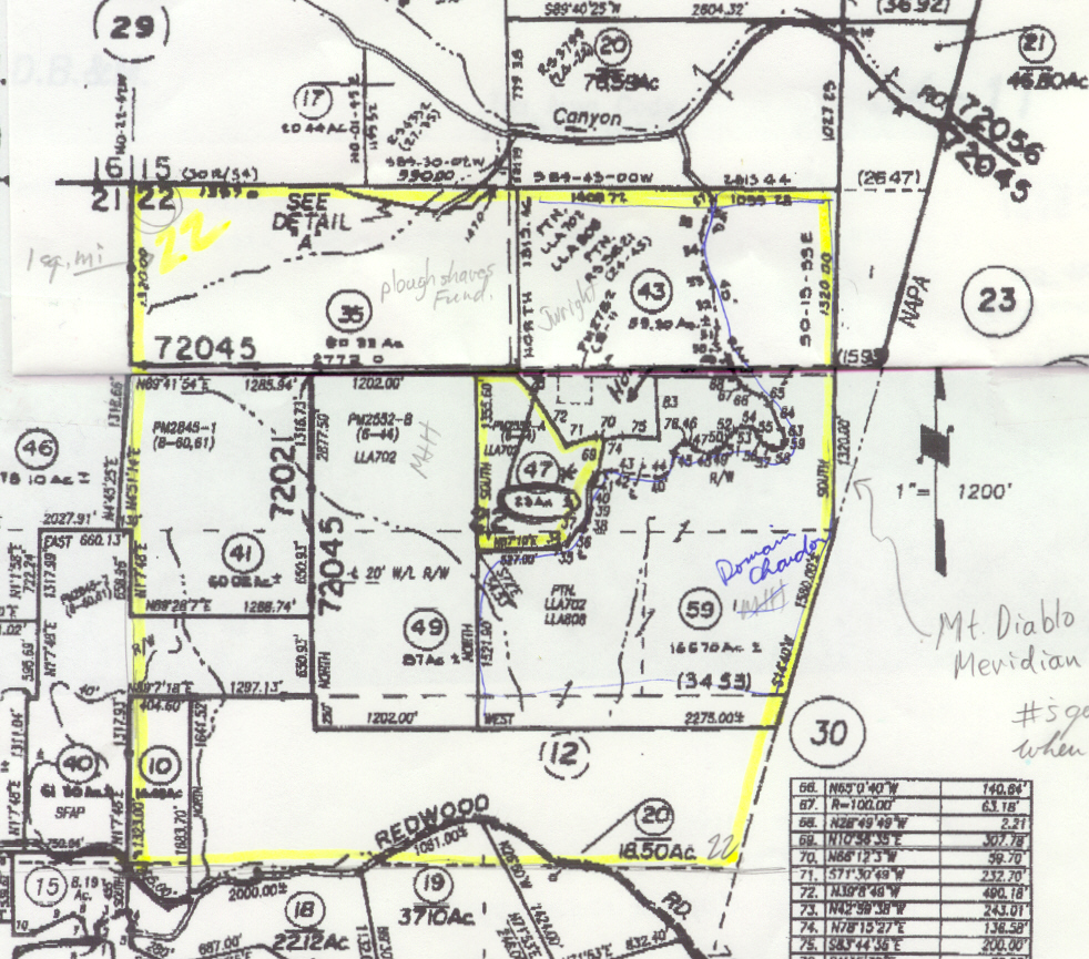
Whole Property Map with Lot Line
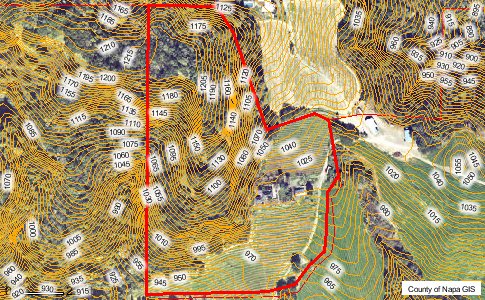
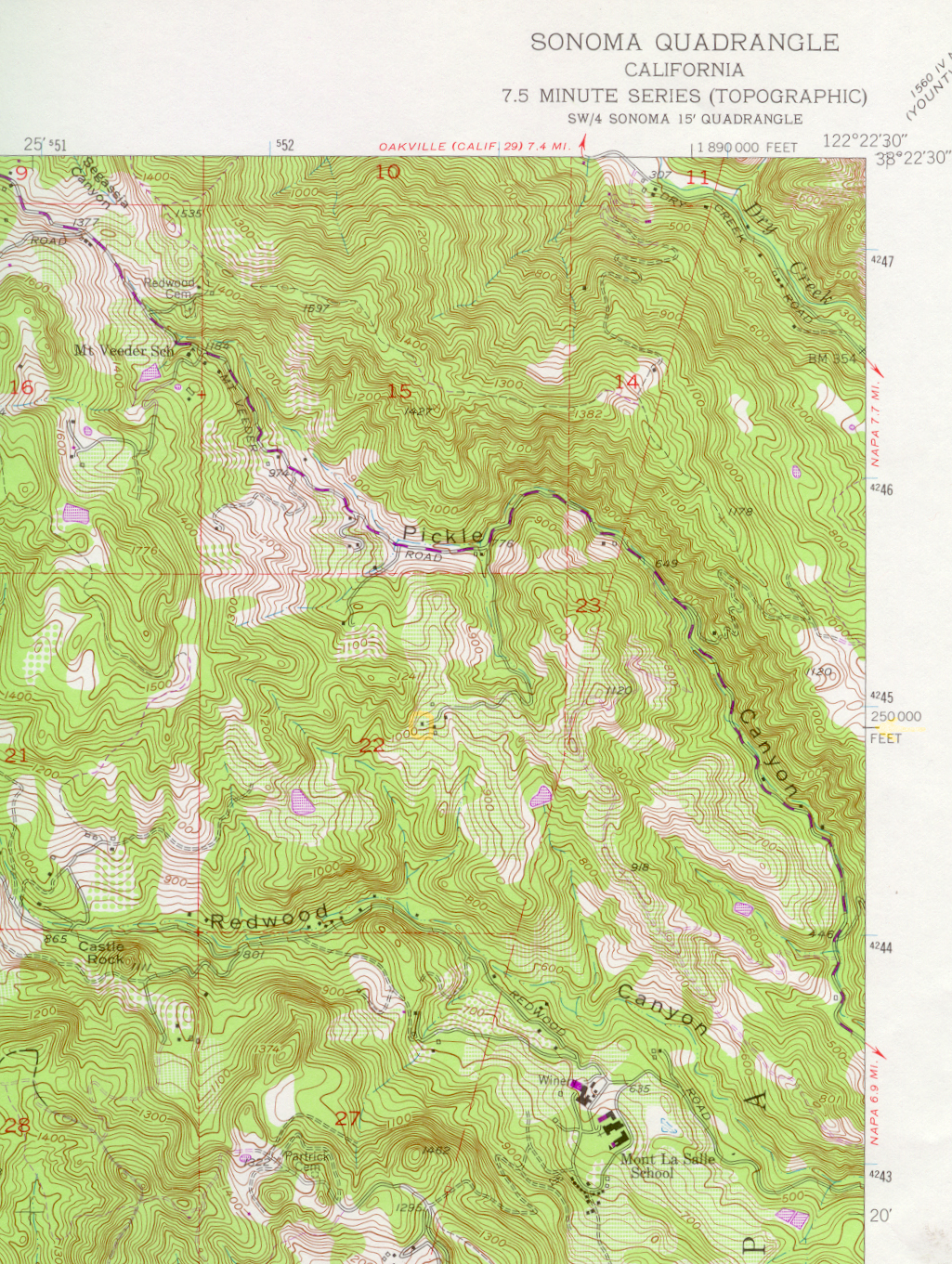
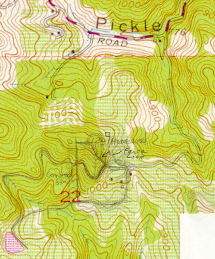
Topo map showing geography of the location.
